| Ride Stats |
|
Distance:
49.03 miles
|
Altitude Gain:
2,284 ft
|
Avg Speed:
12.91 mph
|
|
Route:
Rabbittown
|
Avg Grade: 0 %
|
Max Grade: 0 %
|
|
Max HR: 143 bpm
|
Avg HR: 118 bpm
|
Terrain: Road: Rolling
|
|
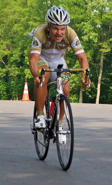
Bike: Look Blade RS 795 Iconic Ltd Road
|
Club: Schuyler County Cycling Club |
| Weather Conditions: Sunny 79 F NW wind @ 5 mph |
|
With my modest climbing goal for Alabama out of the way after my journey over the mountain yesterday opted for a long slow ride today. Looked at the map and saw there was a place called Rabbittown on the map about twenty-five miles north through flat to rolling terrain. Once I got to the town, I would cross a mountain ridge through King Mountain Gap and return on a parallel valley again on mostly flat terrain. Since I would start out riding into a slight headwind, odds were that I would have a tailwind on the back nine. Legs felt good on the way out and had more movement in my neck and enjoyed the ride through mostly woods and farmland. Occasionally found myself on a major highway but shoulder was good and there was only light traffic. Looked forward to the mystery of Rabbittown hoping there would be a welcoming statue or other local attractions. Would have been pleased to have seen a statue of a wolf implying the name was a trap to lure the gentle creatures in. Was a bit disappointed as though I was on The Rabbittown road found no collections of houses nor warrens. Probably rode through it without even noticing. Ride went wrong after that letdown. Started up the mountain gap with a mile long climb listed at eight percent. Ran out of pavement early which was replaced with loose sand and chunky rocks. Tires weren't wide enough to support steering so got off and started walking hopeful for a better surface ahead. As the grade went up the road kept getting worse with it being mostly washed out. Ended up walking all of the climb often on broken bedrock as the road basically ceased to exist. Calves and cleats both suffered on the mile long ascent and spent a good amount of time looking for vipers that might decide to sun on the warm rock surface. Downhill wasn't any better and continued pushing the bike. It turned out to be a bit easier than the climb and as I neared the bottom the downgrade lessoned and I could occasionally coast on some sections dismounting when the surface got to erratic. Was delighted to be back on pavement as I headed back toward Oxford. Unfortunately for me the walking climb took all the wind out of my sails, and I lightly spun the return with heavy legs. Terrain was mostly flat except for a couple late small climbs. Traffic was also less friendly going into town as it was heavy and there wasn't any shoulder to ride on. It turned out to be a memorable though disappointing outing toady.
0 member views | 3 total views
report problem |
|
|
|
|


 more...