| Ride Stats |
|
Distance:
60.03 miles
|
Altitude Gain:
4,851 ft
|
Avg Speed:
14.15 mph
|
|
Route:
Pilot Mountain- Mt Airy
|
Avg Grade: 0 %
|
Max Grade: 0 %
|
|
Max HR: 149 bpm
|
Avg HR: 119 bpm
|
Terrain: Road: Hills
|
|
Bike: Look Blade RS 795 Iconic Ltd Road
|
Club: Schuyler County Cycling Club |
| Weather Conditions: Sunny 73 F N wind @ 9 mph |
|
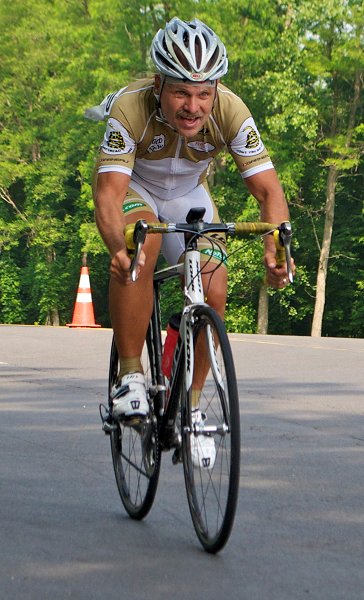
Recovery numbers weren't looking good but decided to ride anyways as tomorrow weather looks colder than the fairer temperatures today. Returned to the foothills again to gain an extra ten degrees and gentler winds. Did another Surry County Scenic Route a few miles to the east of yesterday's route but with similar terrain. One difference today was the route had more straight sections and turned out to be more vulnerable to the wind. The route started in Pilot Mountain at the base of Pilot Mountain State Park. The mountain dominates the area and accounts for many of the routes scenic qualities as it is viewable for several miles of the sixty-mile loop. Course had nineteen climbs listed with a couple hundred feet more elevation than yesterday's route. Didn't think I would have much snap with my poor numbers and figured it would be more of a touring pace with lots of small chainring work even though most of the climbs averaged three to five percent. Not quite sure where to park and drove around town a bit before chancing an athletic center. Think the course originally started at a high school lot but being a school day wasn't comfortable leaving my car there. Lots of signs in the athletic center parking lot stating my plates were being recorded but no NO PARKING signs. Course started out with a tailwind and twelve miles of downgrade which was welcome. Felt better than expected and made good time to a series of four quick climbs at ten percent. Got through those okay and started to climb upward after fifteen miles to reclaim the earlier downgrade. Ran out of leg about twenty-five miles into the ride. Mile long climbs started to every two miles, so it was more spin and coast. Downfall came climbing straight into a nine-mile headwind for a sixteen-mile section. Had to go into survival mode and do most of the remaining climbs in the small chainring. Ride still was entertaining even with dead legs as the downhills were fast, the sun felt great, traffic was light and it was scenic. Northern part of the loop went through Mt Airy (Mayberry). Course didn't go through the tourist area that was a bit disappointing. Used to ride in the area back in the eighties and early nineties doing both the Three Mountain Metric and the Three Mountain Century that had a climb up Pilot Mountain near the end and finished in Mt Airy. The town is quite a bit larger than it was years ago and probably would be considered a city now. Once through Mt Airy there were a couple of two-hundred-foot climbs and the biggest climb of the day at three-hundred-and fifty feet. Payoff though was a five-mile tailwind assisted fast descent to the finish. Turned out to be good course if you like scenery and frequent climbs. Felt a little guilty about being so close to the mountain climbs and not doing them but health is still suspect and am glad to just get some warm miles in.
0 member views | 5 total views
report problem |
|
|
|
| My Blog Calendar
| | << | < | Apr 2026 | > | >> |
| M | T | W | T | F | S | S |
| |
|
1 |
2 |
3 |
4 |
5 |
| 6 |
7 |
8 |
9 |
10 |
11 |
12 |
| 13 |
14 |
15 |
16 |
17 |
18 |
19 |
| 20 |
21 |
22 |
23 |
24 |
25 |
26 |
| 27 |
28 |
29 |
30 |
|
|
|
|